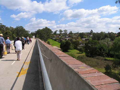
I'll run the tour over a couple of posts so not to bore the pants off you, this is the Boothtown Aqueduct:
(there are some early historic photos of the aqueduct on the council website here and if you are *really* interested, the information signage that is along the route can be read here
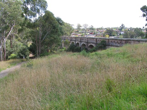

The Boothtown Aqueduct was completed in 1883 as part of the scheme to run water from the Nepean to Sydney, and was designed to link the canal either side of the gully.
It's 225 metres long with 22 arches.
Despite being a majestic landmark, it failed when in 1892 the parapet walls collapsed under the pressure of the water and crashed into the creek below. The walls were reconstructed and lined with concrete.
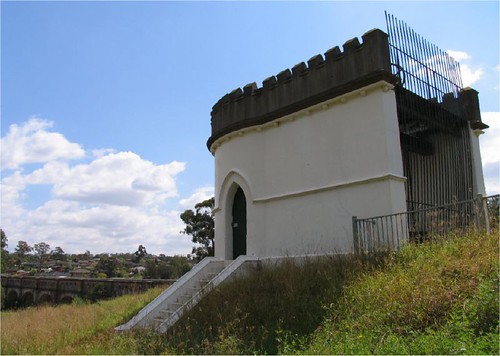
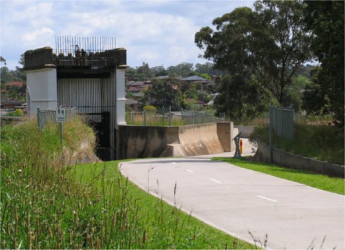
Further failings caused the aqueduct to be bypassed in 1907 by the Boothtown Inverted Syphon and the aqueduct was retained for standby use with large concrete plugs blocking the channel.
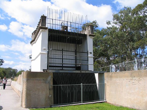
The syphon worked on the principal of water pressure, where the pressure of water on the Prospect dam side forced water to reach the same level on the Merrylands side and continue down the canal.
The castle like towers house the sluice gates which controlled the water flow and trash racks prevented the entry of debris.

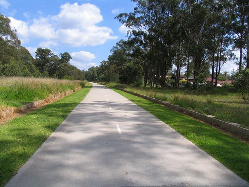
The canal was decommissioned in 1995 and thanks to the efforts of the Canal Reserve Action Group, the area was taken over by Holroyd Council and converted into a walk/cycle way. (The canal land had been fenced off for over a hundred years, enabling the preservation of native vegetation and wildlife)
Here's our group strolling along the top of the aqueduct
If you are very energetic you can walk right to Prospect Dam but there are several entrances and exits along the way.
and all this just a short trolley throw from suburbia